Calculating Springflow
Definitions
- Streamflow
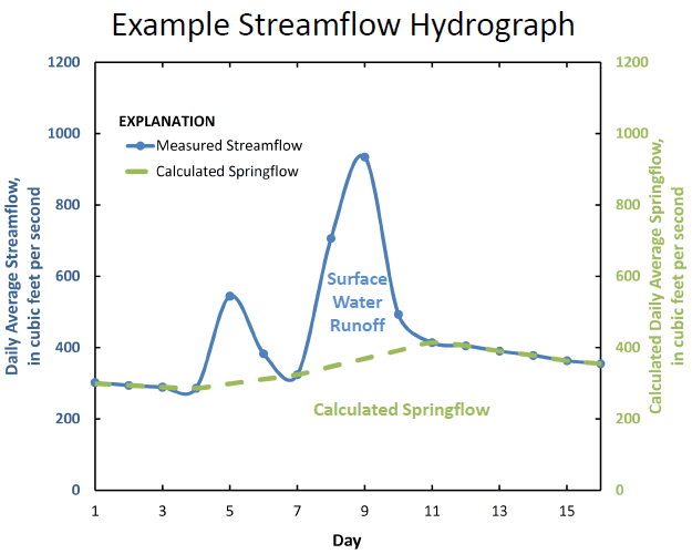
- Streamflow, also referred to as discharge, is the amount of water in the river that passes by a location during a certain amount of time. It is commonly reported in units of cubic feet per second (ft3/s). Streamflow is the combination of surface-water runoff and springflow.
- Surface-water runoff
- Surface-water runoff, as its name suggests, is the overland flow resulting from rainfall that is not absorbed into the ground. Rainfall in this area of Texas can be very intense (high volume of rain in a short period of time), resulting in a substantial amount of surface water runoff.
- Springflow
- Springflow is the groundwater contribution to streamflow, often in the form of springs or seeps. It is sometimes referred to as base flow or groundwater discharge. During dry weather, springflow makes up the majority of the streamflow at Comal and San Marcos Springs.
How is daily average streamflow measured?
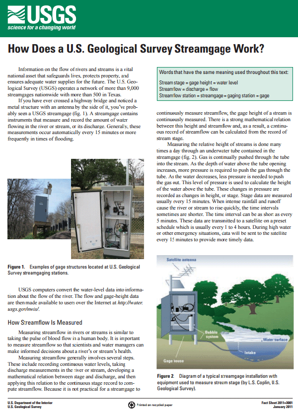
To determine streamflow, several instruments are used to measure the water level in a stream (also known as stream stage or gage height). Using well-established mathematical relations, the height of the water level is converted to streamflow (Turnipseed and Sauer, 2010). The USGS measures streamflow at gaging stations every 15 minutes. The daily average streamflow is the average streamflow measured over the course of that day (also reported in cfs).

USGS Fact Sheet 2011-3001: How does a U.S. Geological Survey streamgage work?

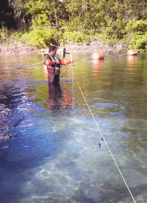
USGS staff making a streamflow measurement at the Comal River.

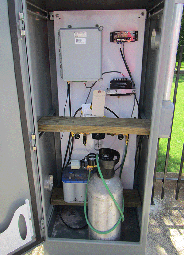
USGS streamflow gaging station housing and equipment at the San Marcos River.
How is daily average springflow calculated?
Springflow at Comal and San Marcos springs cannot be measured directly because there are several places from which water comes from the ground, and many of those places are under water at Landa Lake (for Comal springs) and Spring Lake (for San Marcos springs). Hence, daily average springflow is computed from average daily streamflow data using a computer program. This approach assumes that springflow will change by only a small percentage from day to day, based on hydrologic conditions of the contributing regional groundwater aquifer. For example, if the aquifer water level is decreasing (such as during periods of drought), then the springflow will similarly decrease.

Therefore, the daily average springflow at USGS gaging station 08168710 Comal Springs at New Braunfels, TX is equal to daily average streamflow at 08169000 Comal River at New Braunfels, TX, except for periods when there is local surface water runoff. Similarly, the daily average springflow at USGS gaging station 08170000 San Marcos Springs at San Marcos, TX is equal to daily average streamflow at 08170500 San Marcos River at San Marcos, TX, except for periods when there is local surface water runoff.
When surface water runoff from storms contributes to streamflow, a computation is performed to separate daily average streamflow into surface-water runoff and springflow. The contributions of surface water runoff and springflow are calculated by using a computer program which follows standard springflow separation methods (Barlow and others, 2015; Wahl and Wahl, 1995; and Wahl and Wahl, 1988; Swan and Condie, 1983). The computer program essentially draws a line between the springflow before the storm event and after the storm event (at points when the springflow is once again equal to the streamflow). During storm events, the computer program is not able to separate streamflow into surface-water runoff and springflow; hence, the springflow is manually estimated by USGS staff. After the storm event, the computer program is rerun and the previously estimated values are replaced with the computer calculated values.
The USGS completes a series of quality-control checks to evaluate the computer-calculated or manually-estimated springflows. For example, one logic test that is performed ensures the calculated springflow does not exceed the measured streamflow. This can occur when field streamflow measurements (made at routine intervals to evaluate the accuracy of reported streamflow values) causes a “shift” to the reported discharge. Another quality-control check is to evaluate all the previously estimated values and replace them with calculated values from the computer program (for example, when streamflow returns to stable conditions after a storm event). A subsequent quality-control check is to make sure the values are all reasonable, do not exceed a reasonable percentage change from the previous day, and make hydrologic sense given the hydrologic conditions (for example, during wet or dry periods).
When the data (whether calculated using the computer program or estimated manually) are reviewed, the data are posted on the USGS National Water Information System (NWIS) and marked as “provisional subject to change”. Any highlights or comments noted by the hydrographer are also posted. As a final quality-control check, all streamflow and springflow measurements are reviewed by two additional USGS staff personnel before they are published as “approved” data.
For more information about streamflow and springflow, please contact the USGS Oklahoma-Texas Water Science Center.
