The need for timely, accurate, and complete streamflow data is critical during floods and heavy rains because these data are relied on by local, State, and Federal emergency management personnel for flood response purposes. The USGS Oklahoma-Texas Water Science Center is developing flood early warning systems with elevated streamgages, redundant monitoring and reporting equipment, and multiple communication systems. These systems will give first responders and citizens reliable and timely data during rapidly changing flood events.
For more information about our flood expertise, visit our Flood Early Warning Science in Oklahoma and Texas web page.
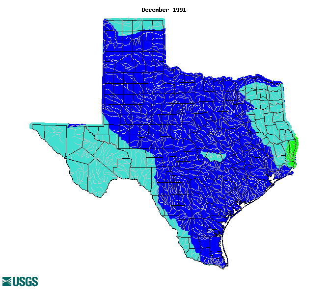
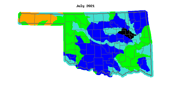
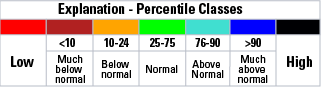
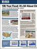
Streamflows that are much above normal are shown in blue and black on the map.
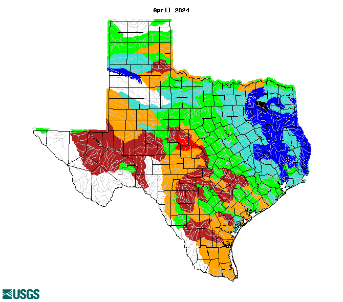
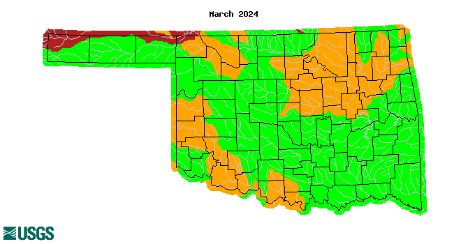
Streamflows that are much above normal are shown in blue and black on the map.
U.S. Geological Survey Fact Sheet 2006-3026

U.S. Geological Survey Fact Sheet 209-95
U.S. Geological Survey Fact Sheet 076-03
U.S. Geological Survey Circular 1245
U.S. Geological Survey General Interest Publication 106
U.S. Geological Survey General Interest Publication 133a
Major and Catastrophic Storms and Floods in Texas
Floods in Central Texas, September 7-14, 2010
Monitoring Inland Storm Surge and Flooding from Hurricane Ike in Texas and Louisiana, September 2008
Flood Tracking Chart for the Upper San Jacinto River Basin near Houston, Texas
Floods in the Guadalupe and San Antonio River Basins in Texas, October 1998
Floods in south-central Texas, June 1997
USGS Flood Related Publications
USGS Publications Warehouse: Oklahoma and Texas Flood publications